
Precision Agriculture Technicians

Overview

Precision Agriculture Technicians use advanced mapping tools, like GPS and GIS software, to help farmers decide exactly where and how much to plant, water, or spray in each part of a field. They collect data from sensors, drones, and harvesters, then create detailed maps that show soil quality, crop health, and yield so farms can use fewer chemicals, save money, and protect the environment. They also set up and program smart farm equipment—such as GPS-guided tractors and variable-rate sprayers—and advise farm managers on how to upgrade and fine-tune this technology for better results.
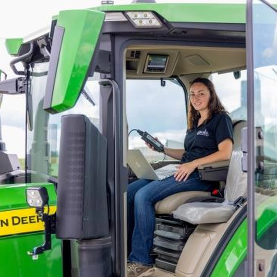
Precision Agriculture Technicians

Did you know?

The field requires ongoing education in emerging technologies like AI, IoT sensors, and data analytics as precision agriculture rapidly evolves.

At a Glance

Growth

Stable

Top Skill

Negotiation

Key Responsibilities

  • Advise farmers on upgrading Global Positioning System (GPS) equipment to take advantage of newly installed advanced satellite technology.
  • Program farm equipment, such as variable-rate planting equipment or pesticide sprayers, based on input from crop scouting and analysis of field condition variability.
  • Demonstrate the applications of geospatial technology, such as Global Positioning System (GPS), geographic information systems (GIS), automatic tractor guidance systems, variable rate chemical input applicators, surveying equipment, or computer mapping software.
  • Identify areas in need of pesticide treatment by analyzing geospatial data to determine insect movement and damage patterns.
  • Prepare reports in graphical or tabular form, summarizing field productivity or profitability.
  • Create, layer, and analyze maps showing precision agricultural data, such as crop yields, soil characteristics, input applications, terrain, drainage patterns, or field management history.
  • Provide advice on the development or application of better boom-spray technology to limit the overapplication of chemicals and to reduce the migration of chemicals beyond the fields being treated.
  • Identify spatial coordinates, using remote sensing and Global Positioning System (GPS) data.
  • Document and maintain records of precision agriculture information.
  • Analyze remote sensing imagery to identify relationships between soil quality, crop canopy densities, light reflectance, and weather history.
  • Analyze data from harvester monitors to develop yield maps.
  • Analyze geospatial data to determine agricultural implications of factors such as soil quality, terrain, field productivity, fertilizers, or weather conditions.
  • Compare crop yield maps with maps of soil test data, chemical application patterns, or other information to develop site-specific crop management plans.
  • Install, calibrate, or maintain sensors, mechanical controls, GPS-based vehicle guidance systems, or computer settings.
  • Recommend best crop varieties or seeding rates for specific field areas, based on analysis of geospatial data.
  • Draw or read maps, such as soil, contour, or plat maps.
  • Participate in efforts to advance precision agriculture technology, such as developing advanced weed identification or automated spot spraying systems.
  • Contact equipment manufacturers for technical assistance, as needed.
  • Use geospatial technology to develop soil sampling grids or identify sampling sites for testing characteristics such as nitrogen, phosphorus, or potassium content, pH, or micronutrients.
  • Divide agricultural fields into georeferenced zones, based on soil characteristics and production potentials.
  • Apply precision agriculture information to specifically reduce the negative environmental impacts of farming practices.
  • Collect information about soil or field attributes, yield data, or field boundaries, using field data recorders and basic geographic information systems (GIS).

Career Considerations

Continuous Technology Learning

The field requires ongoing education in emerging technologies like AI, IoT sensors, and data analytics as precision agriculture rapidly evolves.

Geographic Job Concentration

Employment opportunities are primarily located in major agricultural regions such as the Midwest, California's Central Valley, and the Great Plains states.

Growing Industry Demand

The profession offers strong job growth potential due to increasing adoption of sustainable farming practices and government incentives for agricultural technology.

Want to dig deeper?

Talk to blinky to learn more.

Start chatting
BETA
New York

25 Kent Ave, Suite 401
Brooklyn, NY
11249


North Carolina

204 N Person
Street. Raleigh, NC
27601

Australia

Level 4/80
Wentworth Ave,
Surry Hills,
Sydney, 2010