
Surveying and Mapping Technicians

Overview

Surveying and Mapping Technicians collect precise measurements of land and create detailed maps using high-tech equipment like GPS devices and specialized software. They split their time between outdoor fieldwork, where they visit sites to gather data and set up surveying instruments, and office work, where they use computers to process information and create digital maps. These professionals work closely with surveyors and cartographers to produce maps that show property boundaries, elevation changes, and terrain features. The job combines outdoor adventure with cutting-edge technology, and many technicians enjoy the variety of working both independently in the field and collaboratively in team environments.
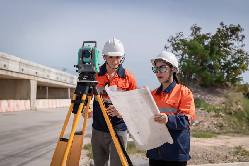
Surveying and Mapping Technicians

Did you know?

Most employers require an associate degree or certificate in surveying, geographic information systems (GIS), or a related field, with some states requiring licensure for certain surveying activities.

At a Glance

Median Wage

$54,022.16 Avg/yr

Growth

Fast Growing

Top Skill

Operations Analysis

Key Responsibilities

  • Record survey measurements or descriptive data, using notes, drawings, sketches, or inked tracings.
  • Search for section corners, property irons, or survey points.
  • Enter Global Positioning System (GPS) data, legal deeds, field notes, or land survey reports into geographic information system (GIS) workstations so that information can be transformed into graphic land descriptions, such as maps and drawings.
  • Answer questions and provide information to the public or to staff members regarding assessment maps, surveys, boundaries, easements, property ownership, roads, zoning, or similar matters.
  • Complete detailed source and method notes describing the location of routine or complex land parcels.
  • Compare topographical features or contour lines with images from aerial photographs, old maps, or other reference materials to verify the accuracy of their identification.
  • Compile information necessary to stake projects for construction, using engineering plans.
  • Monitor mapping work or the updating of maps to ensure accuracy, inclusion of new or changed information, or compliance with rules and regulations.
  • Collect information needed to carry out new surveys, using source maps, previous survey data, photographs, computer records, or other relevant information.
  • Conduct surveys to ascertain the locations of natural features and man-made structures on the Earth's surface, underground, and underwater, using electronic distance-measuring equipment, such as GPS, and other surveying instruments.
  • Compare survey computations with applicable standards to determine adequacy of data.
  • Provide assistance in the development of methods and procedures for conducting field surveys.
  • Calculate latitudes, longitudes, angles, areas, or other information for mapmaking, using survey field notes or reference tables.
  • Produce or update overlay maps to show information boundaries, water locations, or topographic features on various base maps or at different scales.
  • Adjust and operate surveying instruments such as prisms, theodolites, electronic distance measuring equipment, or electronic data collectors.
  • Prepare topographic or contour maps of land surveyed, including site features and other relevant information, such as charts, drawings, and survey notes.
  • Identify and compile database information to create requested maps.
  • Design or develop information databases that include geographic or topographic data.
  • Prepare cost estimates for mapping projects.
  • Research and combine existing property information to describe property boundaries in relation to adjacent properties, taking into account parcel splits, combinations, or land boundary adjustments.
  • Perform calculations to determine earth curvature corrections, atmospheric impacts on measurements, traverse closures or adjustments, azimuths, level runs, or placement of markers.
  • Analyze aerial photographs to detect and interpret significant military, industrial, resource, or topographical data.
  • Trace contours or topographic details to generate maps that denote specific land or property locations or geographic attributes.
  • Supervise or coordinate activities of workers engaged in surveying, plotting data, drafting maps, or producing blueprints, photostats, or photographs.
  • Determine scales, line sizes, or colors to be used for hard copies of computerized maps, using plotters.
  • Position and hold the vertical rods, or targets, that theodolite operators use for sighting to measure angles, distances, and elevations.
  • Operate and manage land-information computer systems, performing tasks such as storing data, making inquiries, and producing plots and reports.
  • Set out and recover stakes, marks, or other monumentation.
  • Check all layers of maps to ensure accuracy, identifying and marking errors and making corrections.
  • Trim, align, and join prints to form photographic mosaics, maintaining scaled distances between reference points.

Career Considerations

Education and Certification Requirements

Most employers require an associate degree or certificate in surveying, geographic information systems (GIS), or a related field, with some states requiring licensure for certain surveying activities.

Technology Proficiency

Proficiency in GPS equipment, GIS software (such as ArcGIS), and computer-aided drafting (CAD) programs is essential for success in this field.

Physical Work Environment

The job involves significant outdoor fieldwork in various weather conditions and terrain, requiring physical stamina and the ability to carry surveying equipment.

Want to dig deeper?

Talk to blinky to learn more.

Start chatting
BETA
New York

25 Kent Ave, Suite 401
Brooklyn, NY
11249


North Carolina

204 N Person
Street. Raleigh, NC
27601

Australia

Level 4/80
Wentworth Ave,
Surry Hills,
Sydney, 2010